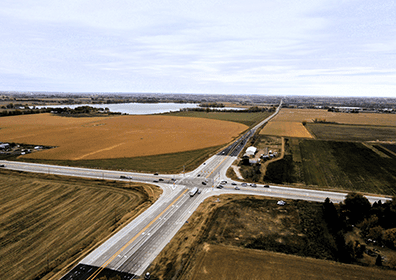
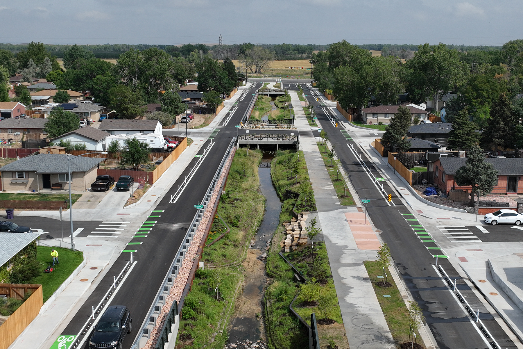
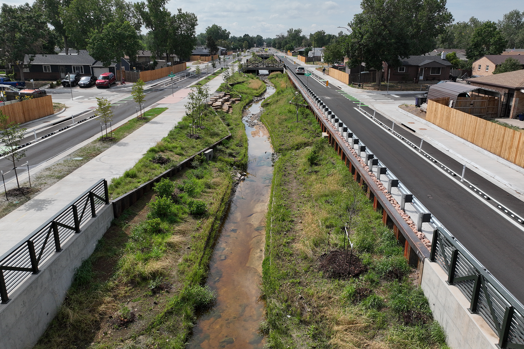
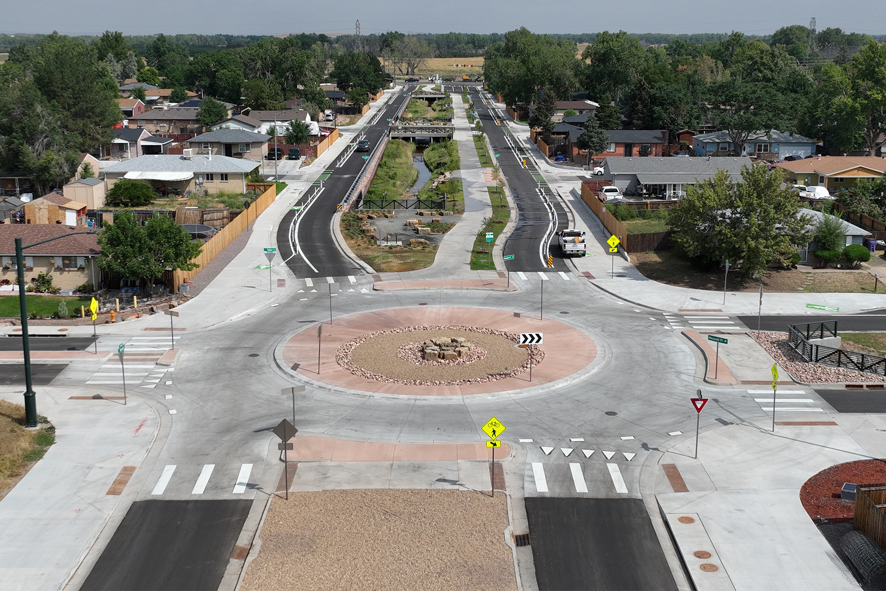
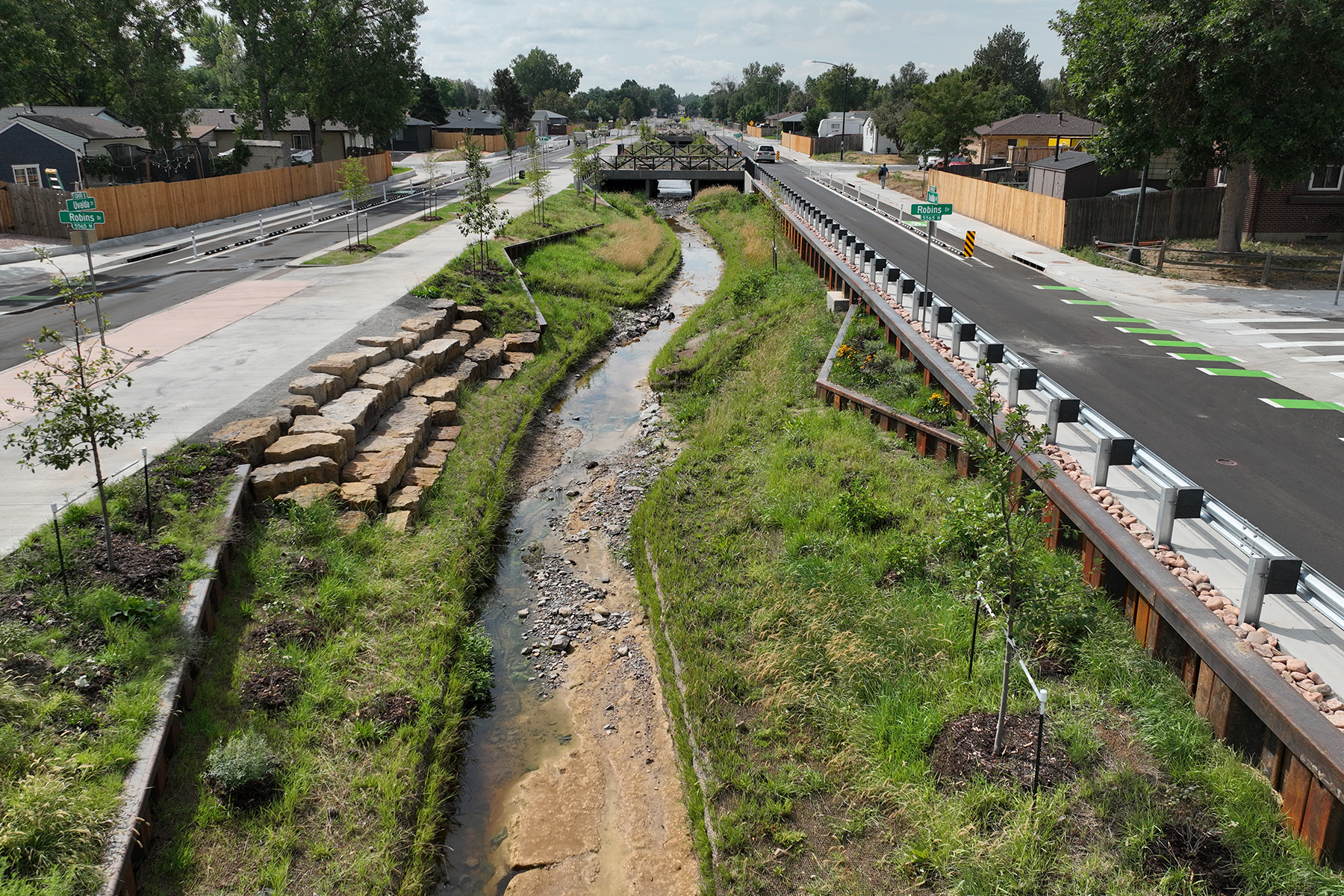
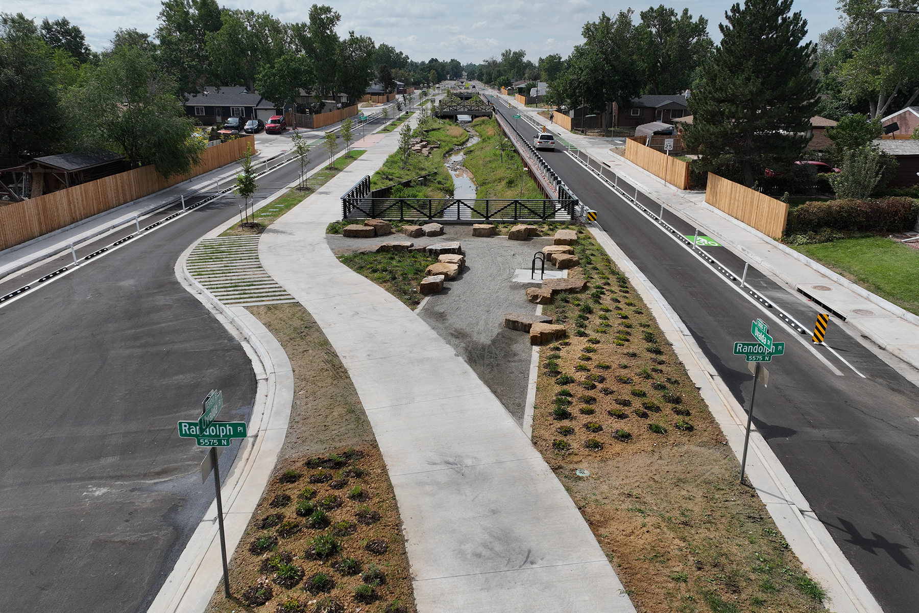
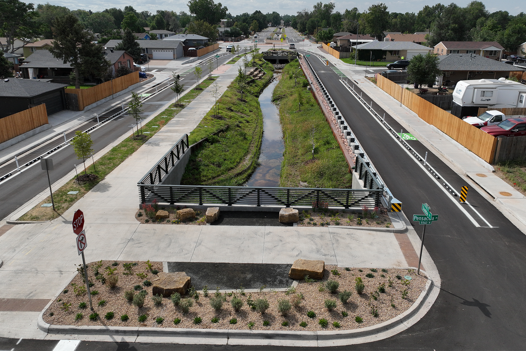
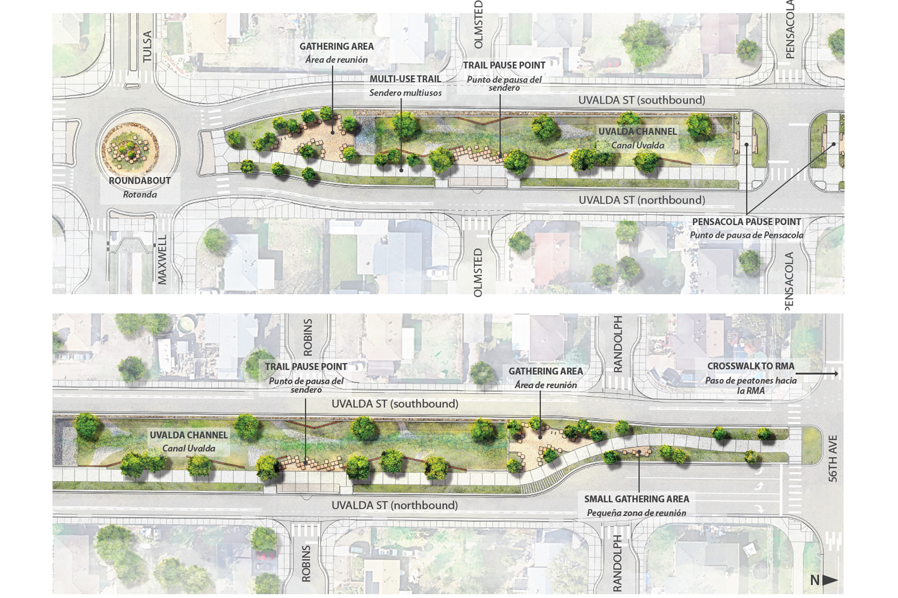
Uvalda Tributary to Irondale Drainage project limits include 1,300 feet of Uvalda channel north of 56th Avenue, the intersection of Uvalda Street and 56th Avenue, and Uvalda Street/channel from 56th Avenue south to the intersection with Maxwell Place. The primary project objective was to improve the hydraulic conveyance of Uvalda channel and identify the necessary hydraulic-related improvements at the intersection of 56th Avenue and Uvalda Street, and to effectively coordinate with the City’s separately contracted 56th Avenue roadway design project.
The hydraulic evaluation included open channel analysis, culvert analysis, and potentially even split-flow analysis to fully understand the existing conditions and develop improvement alternatives. The primary hydraulic analysis alternatives were on the channel along Uvalda Street. Cross-section alternatives were developed, channel hydraulic analysis were performed, culverts will be analyzed, and a memorandum which discusses the alternatives and provides recommendations was prepared for MHFD and City review.
North of 56th Avenue, the Uvalda channel improvements focus on improving the upstream culvert hydraulics at 56th Avenue.
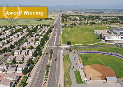
While the primary project purpose was to improve major drainage conditions, Uvalda channel is an integral part of the roadway corridor and neighborhood. The 2019 Far Northeast Area Plan identifies a desire for all Montbello channels to better convey stormwater, improve water quality, and support recreational and transportation amenities. To meet the vision and goals of the Plan, Muller’s work included a holistic evaluation of the Uvalda Street corridor from 56th Avenue to Maxwell Place. The evaluation included roadway lane configurations, parking, bicycle and pedestrian movements, bus routes, traffic calming and safety, water quality, adding trees and greenspace, and aesthetics. Specific attention was given to the intersections of Uvalda Street with 56th Avenue and Maxwell Place. Muller provided a memorandum which discussed the overall roadway corridor alternatives and provided recommendations for MHFD and City review.
Colorado Contractors Association’s Infrastructure Construction Excellence Awards in the category of “Waterway restoration/construction flood control/prevention over $10M”
0.3 miles of Bike Lanes | 4 Concrete Box Culverts | 898 feet of Concrete Box Culvert | 48 Curb Ramp Improvements and Upgrades (Includes detectable warnings) | 2 Detention Ponds | 1 Roundabout Intersection | 5 Intersection Designs | 0.3 miles of Urban Roadway | 0.4 miles of Sidewalk | 898 feet of Storm Drain 48-inch and larger | 1,778 feet of Storm Drain – All Sizes | 1 Major Storm Drain Outfall | 0.3 miles of Stream Restoration/Stream Design | 0.4 miles of Non-Mountain Trails | 1,573 feet of Water Lines

