


- All
- Stormwater & Floodplain Management
- Water & Wastewater Utilities
- Transportation Planning & Design
- Traffic Engineering & Intelligent Transportation Systems
- Structural & Bridge Design
- Environmental
- Planning & Program Management
Aurora Traffic Signal Timing
Spader Way Pedestrian Crossing Broomfield, Colorado Under several on-call task orders, Muller Read More
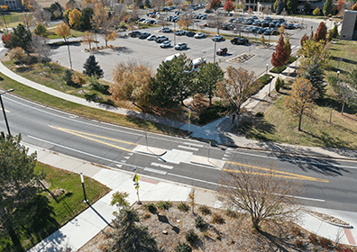
Spader Way Pedestrian Crossing
Spader Way Pedestrian Crossing Broomfield, Colorado The Muller team designed an enhanced Read More
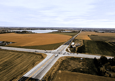
US 287 / CO 52 Intersection Safety Improvements
US 287 / CO 52 Intersection Safety Improvements Boulder County, Colorado Muller Read More
Siena Pump Station and Transmission Line
Siena Pump Station and Transmission Line Broomfield, Colorado To meet peak summer Read More
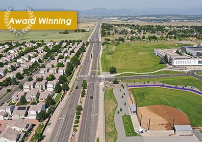
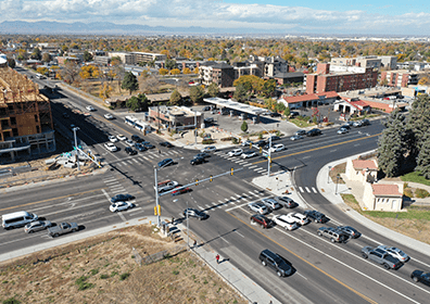
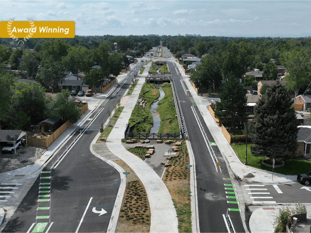
Dillon Road/West 144th Avenue Improvements
Dillon Road/West 144th Avenue Improvements Broomfield, Colorado Increasing traffic volumes in the Read More
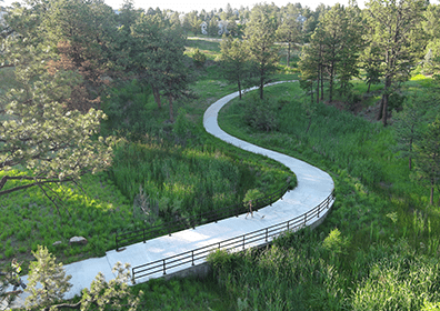
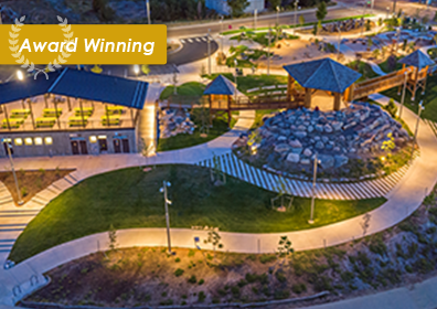
City Park Nature Play and Waterway Restoration
City Park Nature Play and Waterway Restoration Denver, Colorado City Park Nature Read More

Eastlake at 124th Station Streetscape and Plaza Improvements
Eastlake At 124th Station Streetscape and Plaza Improvements Thornton, Colorado Muller performed Read More

Kentucky Avenue and Irving Street Park and Intersection Improvements
Kentucky Avenue and Irving Street Park and Intersection Improvements Denver, Colorado Muller Read More
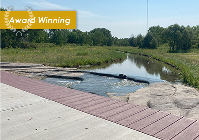
Timbers Creek Channel Stabilization
Timbers Creek Channel Stabilization Douglas County, Colorado Muller performed design engineering for Read More
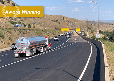
I-70 Mount Vernon Emergency Escape Ramp Reconstruction
I-70 Mount Vernon Emergency Escape Ramp Reconstruction Jefferson County, Colorado Tragedy struck Read More
Uvalda Tributary to Irondale Drainage
Uvalda Tributary to Irondale Drainage Denver, Colorado Uvalda Tributary to Irondale Drainage Read More
Cherry Creek Stream Restoration at Dransfeldt Extension
Cherry Creek Stream Restoration at Dransfeldt Extension Parker, Colorado The Cherry Creek Read More
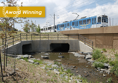
West Corridor Light Rail Transit
Drainage Improvements For The West Corridor Light Rail Transit Project Lakewood, Colorado Read More
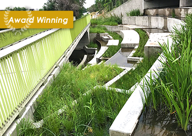
33rd Street Outfall
33rd Street Outfall Denver, Colorado The 33rd Street Storm Sewer Outfall, located Read More

38th and Holly Detention Pond
38th and Holly Detention Pond Denver, Colorado This project included a reconstructed Read More

Sand Creek Regional Greenway Trail
Sand Creek Regional Greenway Trail Denver, Colorado In partnership with Mile High Read More

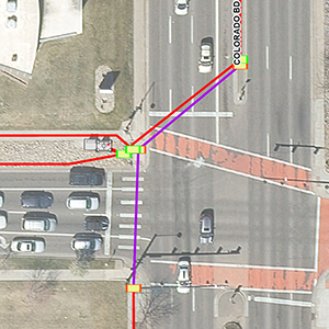
1st Avenue at Emery Street Intersection Improvements and Railroad Crossing
1St AVENUE AT EMERY STREET INTERSECTION IMPROVEMENTS AND RAILROAD CROSSING Longmont, Colorado Read More
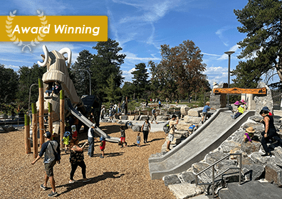
Nature Playground at Westminster Station Park
The Nature Playground at Westminster Station Park Westminster, Colorado Interactive Nature Play Read More
City and County of Denver Fiber Communications Mapping
City and County of Denver Fiber Communications Mapping denver, Colorado Under an Read More
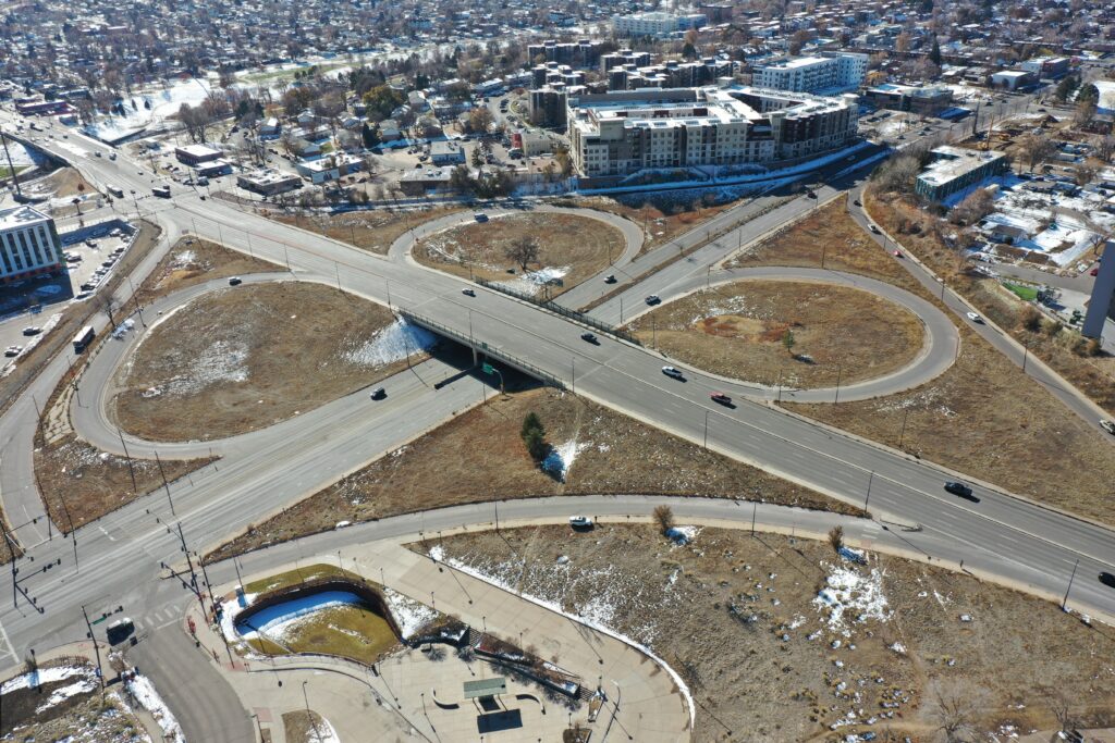
Federal And Colfax Interchange Transformation Study
Federal & Colfax Interchange transformation Study Denver, Colorado The City and County Read More