
Monument Creek at Mark Dabling Boulevard
Monument Creek
Image Taken Date
This project aims to enhance the long-term stability and ecological function of a 1,500-foot reach of Monument Creek within the City of Colorado Springs. This project, funded through a Federal Emergency Management Agency (FEMA) Hazard Mitigation Grant Program (HMGP) with matching funds from the City, is designed to mitigate erosion, improve flood resilience, and restore natural stream functions while maintaining safe public access.
Muller, along with our team of subconsultants, is leading the final design for the channel stabilization improvements. Key project elements include channel grading, floodplain bench connections, sculpted concrete grade control structures, bioengineered bank protection, and vegetative restoration. Muller’s role extends from hydrologic and hydraulic analysis to engineering design and permitting, ensuring the project meets regulatory requirements while enhancing the creek’s environmental health and stabilizing the creek corridor.
Our team is developing and refining design solutions through a phased approach—progressing from preliminary (30%) to final (100%) construction-ready plans. This work includes obtaining necessary environmental and floodplain permits, and coordinating with stakeholders to ensure the project aligns with both community goals and regulatory compliance.
By implementing these stabilization measures, the project will reduce erosion potential and flood risk, enhance habitat, and support sustainable waterway management within the urban corridor of Colorado Springs.
Loading...
Project Name
Location

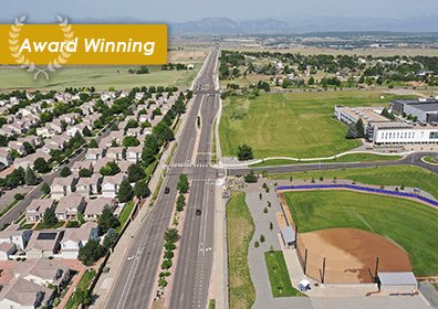
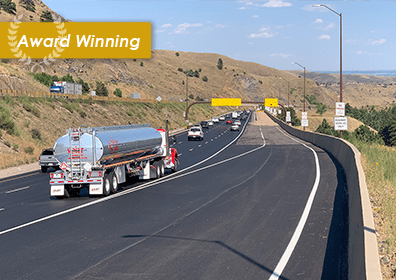
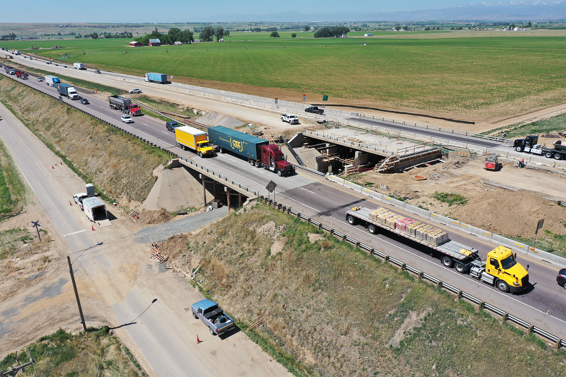
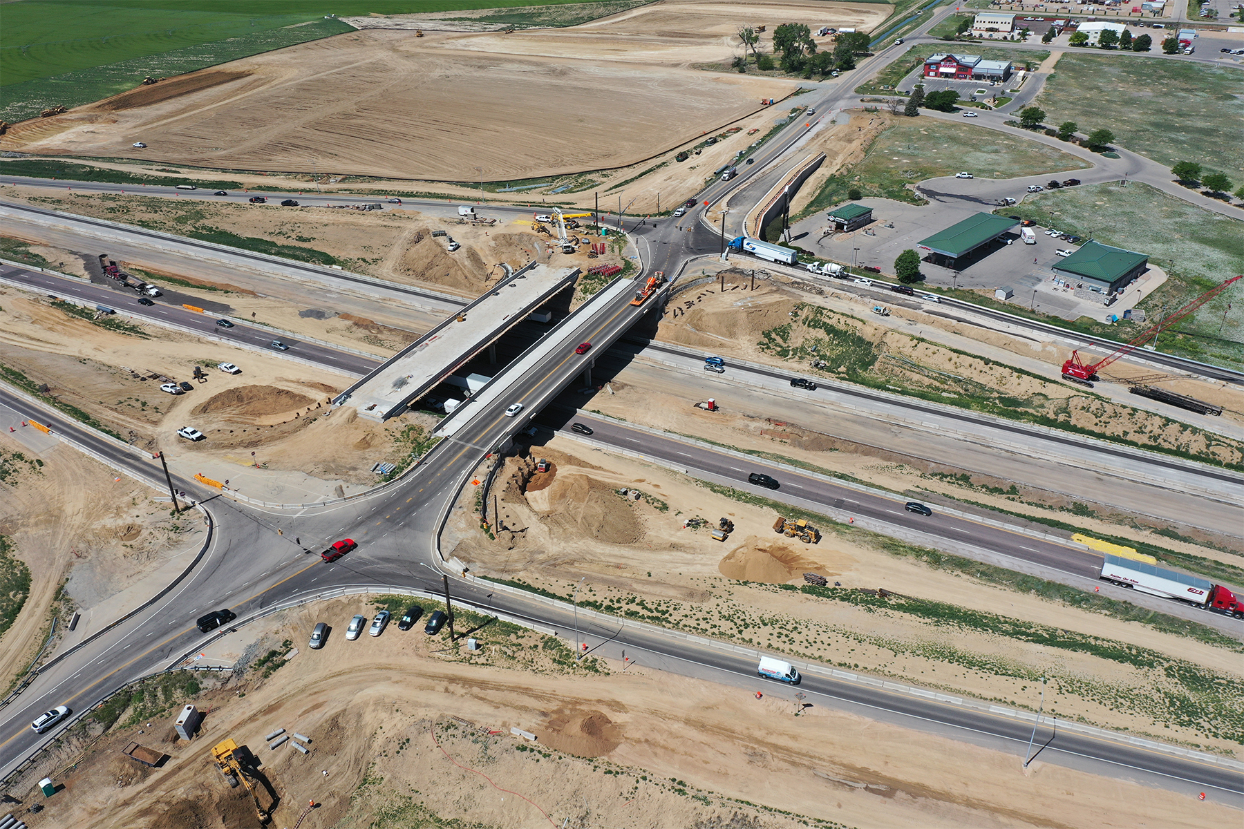
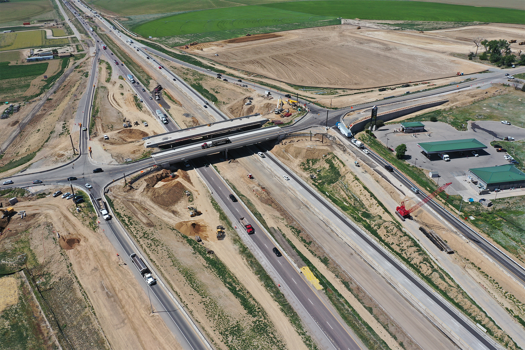
Muller served as prime consultant for this multi-disciplined project team to provide preliminary and final design for an 11.2-mile segment of I-25 North of Denver from CO 66 to CO 402.
Muller’s work on the $500 million project started in 2012 with development of traffic demand models for using managed lanes in the corridor from CO 7 to Fort Collins. Muller then completed the preliminary design for the entire CO 66 to CO 402 corridor segment. During the preliminary design phase, Muller’s structural engineers prepared structure selection reports for 22 bridges. To provide an interim remedy to mitigate rear-end accidents, Muller’s traffic engineers prepared an early action breakout project for four miles of interim safety improvements to be implemented prior to the ultimate improvements. This required widening the south bound lanes and bridge over Valley Road. The project’s preliminary design was completed in four months, with the climbing lane and bridge widening completed in early 2017.
Final design for the remainder of the project was completed in two segments under a CM/GC delivery process. Segment 5 was 6.1 miles long from CO 66 to CO 56 and includes 8 bridges, a parallel frontage road (some may be devolved), 1 interchange, 10 intersections, and ITS improvements (including managed lanes). Segment 6 was 5.1 miles long from CO 56 to CO 402 and included 13 bridges, a parallel frontage road, three interchanges (one diverging diamond with signalization, one with I-25 flipped from under to over), five intersections, two roundabouts, and a park and ride facility.
The I-25 North corridor has a dynamic community of stakeholders, with historic agricultural use remaining active amidst rapid growth and development. In addition to public meetings, our team worked with CDOT to find win-win opportunities and even cost-share partnerships with local agencies, developers, and the Division of Transit and Rail (DTR) to add value to the project.
Overall, the I-25 North Berthoud to Johnstown Reconstruction project has been one of Muller’s largest projects to date: requiring the support of all Muller service areas and encouraging collaboration between our clients, community, and staff. The preliminary and final design of these segments of I-25 North will benefit the connectivity of rural parts of northern Colorado for years to come.
OWNER
CDOT Region 4
SERVICES
Traffic Engineering & ITS
Transportation Planning & Design
Stormwater & Floodplain Management
Structural & Bridge Design
Program Management
Statistics
0.5 Mile of Bike Lanes | 2 Bridge Hydraulic Design and Scour Mitigations | 21 Bridges | 11.2 Miles of Fiber Optic Lines | 4 Interchanges | 17 Intersection Designs | 1 Parking Lot, 130 Parking Spaces | 1 Great Western Railroad Crossing | 11.2 Interstate Roadway Miles | 12.7 Rural Roadway Miles | 1 Urban Roadway Mile | 2 Roundabouts | 2 Traffic Signal Designs | 1 Mile of Mountain Trails
"When contracted to lead the design for the $286 million I-25 Reconstruction from Berthoud to Johnstown, the Muller team once again demonstrated they are a trusted CDOT partner and were up to the task of delivering the final design of the project in just two years. Utilizing the CM/GC project delivery method, CDOT, Muller and our contractor partner were able to design a project that reduced the overall construction package by over $60 million through innovative design and streamlined approaches to construction. Despite the accelerated schedule and the added pressure of the COVID-19 pandemic, the Muller team hit their milestones, all while working remotely and managing a multi-discipline team of approximately 300 people from 15 firms.”
Heather PaddockCDOT Region 4

